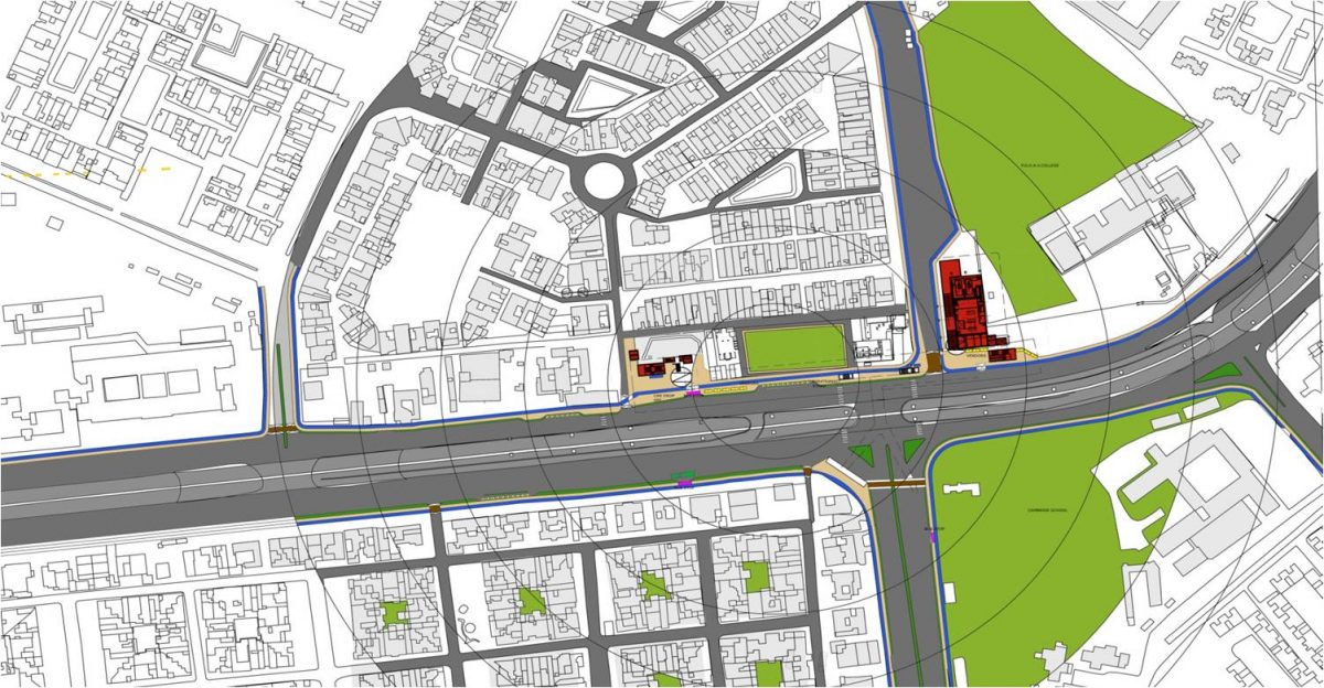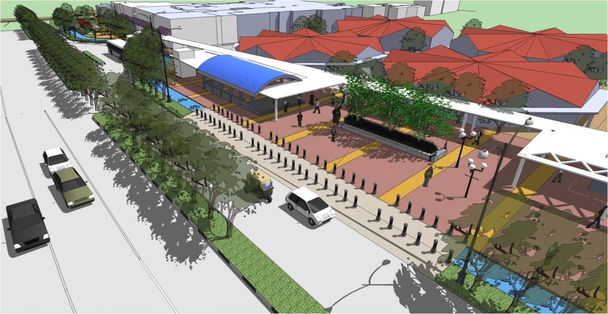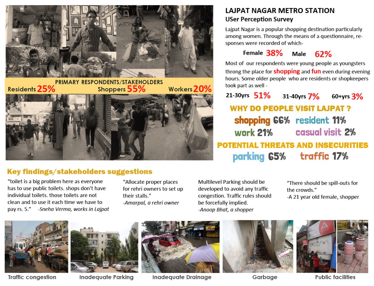
KCA conducted a ‘User Perception Survey’, for Multi Modal Integration of Delhi Metro Stations for UTTIPEC in 2013, recording the perceptions of the key stakeholders comprising residents, shoppers and workers/shopkeepers.
KCA mapped the area around Lajpat Nagar metro station to figure out the key physical features(vendor locations and kiosks, public utilities, street furniture, garbage, greens), activities and traffic issues.
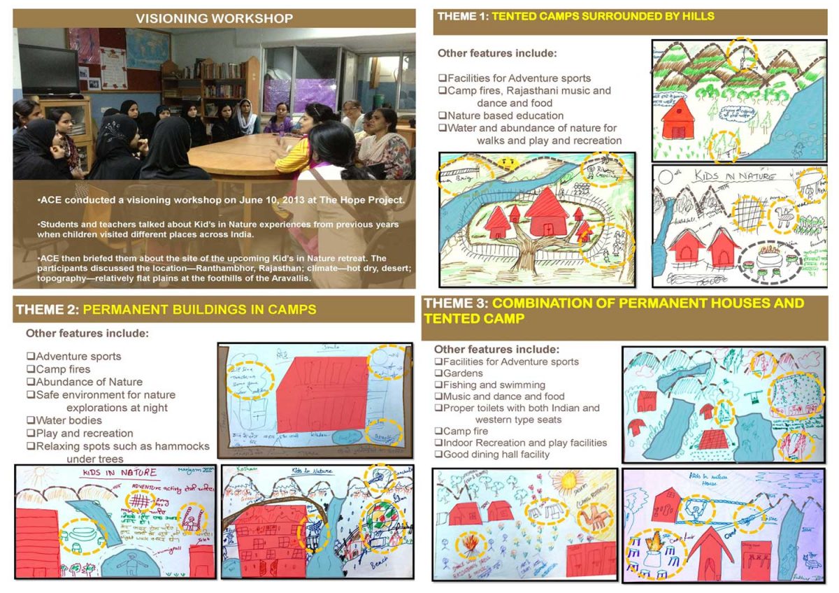
The HOPE Project works with the community in Nizamuddin Basti in the heart of New Delhi. KCA helped the Hope project to develop a special project within its existing programme called Kid’s in Nature to create a specially designed nature retreat close to the city as a permanent place for the Kid’s in Nature programme. In this place children can discover themselves and the world around them in a secure natural environment. KCA conducted workshops with adolescents girls and teachers of the HOPE School who had visited different ecological zones as part of the current programme to conceptualize the retreat.
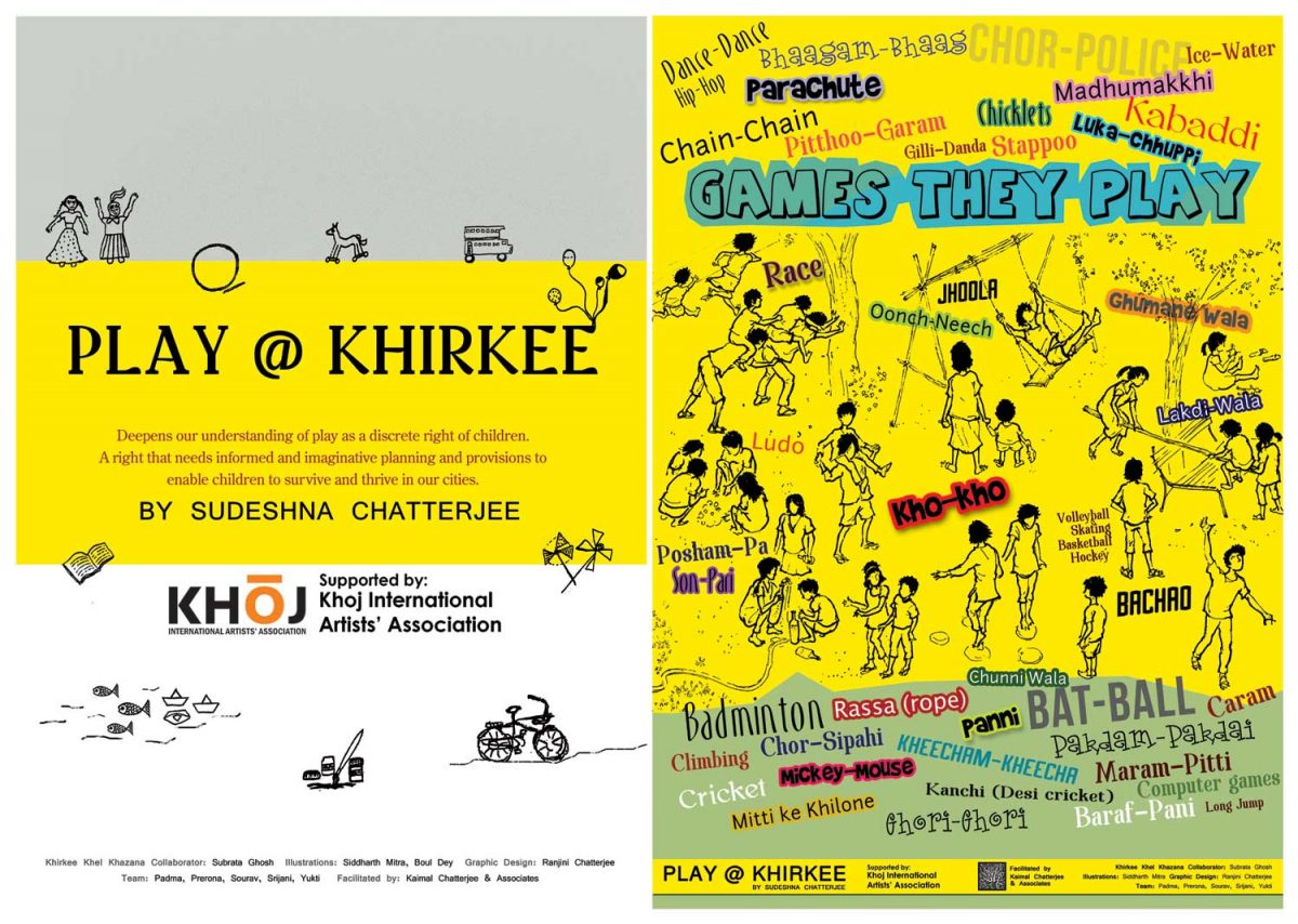
In 2011, Sudeshna Chatterjee was supported by KHOJ International Artists Association, HIVOS and Ford Foundation to do a study exploring children’s play in Khirkee Village in New Delhi. Using ethnographic fieldwork as the primary method, Sudeshna supported by the KCA team explored the nature of play, and the spatial experience of play in a Delhi neighborhood where children do have permission to play outdoors.
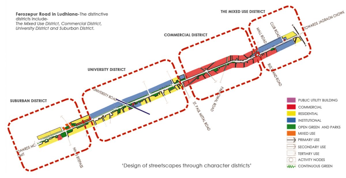
Upgradation and Beautification of Urban Road Network and Cityscape in Ludhiana
This future vision for Ludhiana incorporates public transport, efficient management of para transits, pedestrian streets, cycling and pedestrian infrastructure etc. Upgradation of streetscape and city beautification are interlinked with long-term planning goals for growth and infrastructure management.
Study of modal split, trip lengths, most congested routes, frequent destinations, condition and location of infrastructure, safety issues, accident zones etc along with assessing the capacity and role of the new roads to release pressure on existing city roads, informed short-term and long-term strategies to manage and organize city growth. The master plan of the city provides a great opportunity to rethink the industrial landuse in the heart of the city addressing both the fixed pubic improvements and respond to the adjacent private physical edge and uses aligned along roadways.
Our project methodology and ensuing physical plan recommendations have been conceived to respond to the inevitability of growth and change within Ludhiana. The proposed Upgradation and Beautification Plan is formulated to permit incremental implementation over time through phased capital improvement projects.
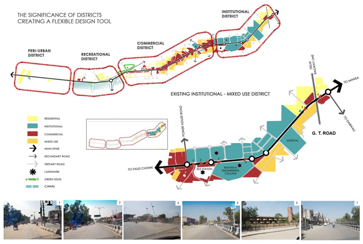
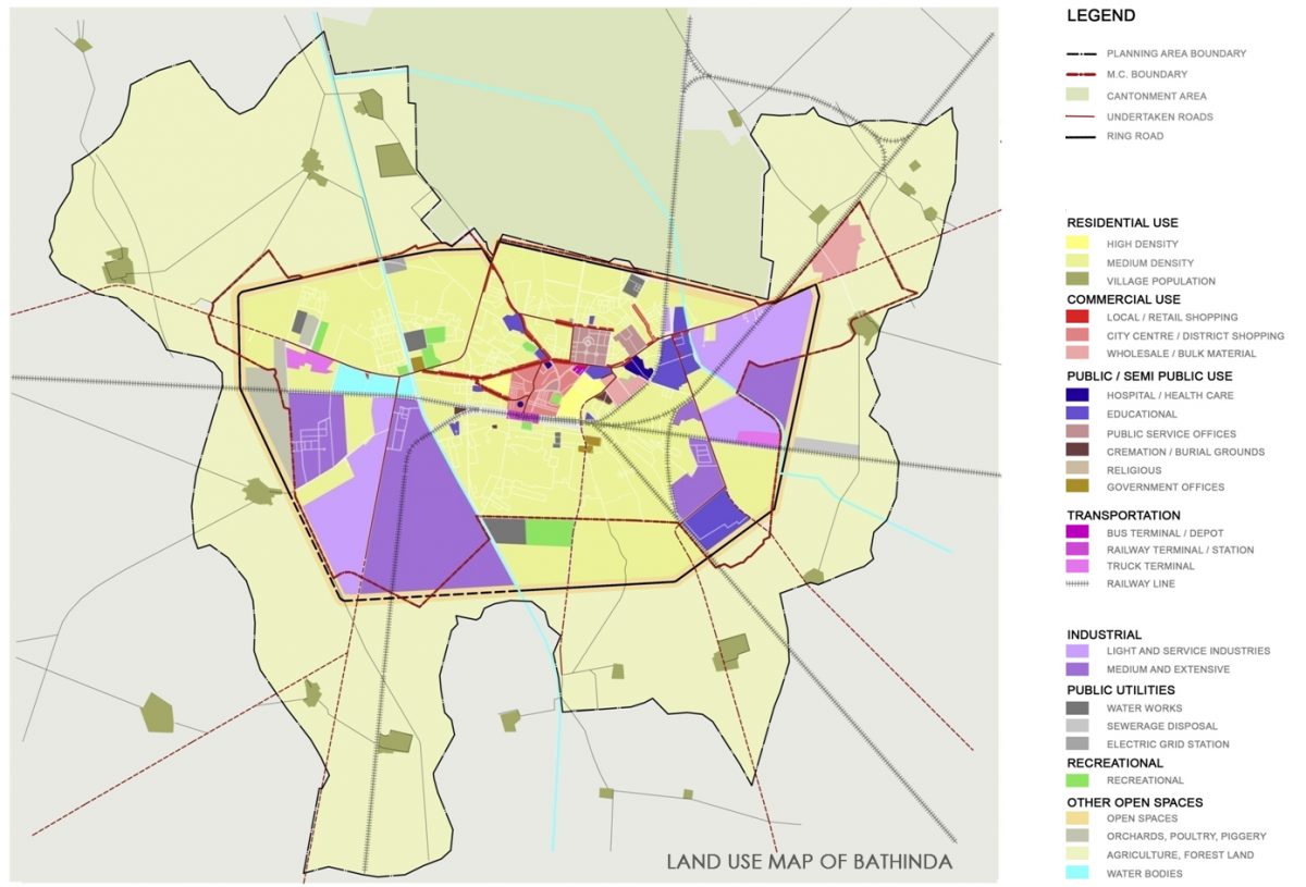
Upgradation and Beautification of Urban Road Network and Cityscape in Bathinda
The road network of the city needs to be understood in relation to current and anticipated land use. Upgradation of streetscape and city beautification are interlinked with long-term planning goals for growth and infrastructure management.
We base our design approach to the streets by first identifying the different urban design character districts in a street. We then develop ideas and concepts for streetscaping related to each district. Every street has distinct character districts based on the surrounding land use, edge conditions, and the nature of use of that stretch of the street.
The ROW has been designed with roadway variants that respond functionally and aesthetically to the districts. Thus, the ROW edge is seen as a condition of interface that is designed to transform to respond to the needs of the district.
This approach and the ability to transform the joining of the ROW to the district edge condition allows the proposed design to respond to district conditions as they may evolve between now and project implementation. Thus, the physical design recommendations are intended to allow Bathinda to make detailed design responses for standard roadway/private land interface to improve the roadway function and allow for beautification applications.

As a part of the approach to improve the cityscape and urban road network of the city, the roads within scope of this project are classified and analyzed based on three parameters – Right of Way (Road width), Character Districts and Urban Transects.
The approach to create design solutions and proposals for Ludhiana Streetscapes is based on creating a Flexible Design Tool.
The ROW has been analyzed and designed with roadway variants that respond functionally and aesthetically to the character districts and transects.
This approach and the ability to transform the joining of the ROW to the district edge condition and the condition of the transect allows the proposed design to respond to district conditions
Our approach to improving cityscape and road network is based on three key ideas:
Typology of Street
Understanding the typology of the street and its location in the overall street network of the city.
Character Districts
Understanding the specific character of different segments of each street, which we call “districts”, as every street displays heterogeneous character over the entire length.
Urban Transect
Understanding the location of each district in the urban transect which organizes the different levels of urbanism from the core of the city to its periphery based on density and massing.